A group of Audubon staff met in New Orleans, Louisiana for a tour of the coast. Whether we’re on the ground connecting to communities, restoring habitat and monitoring bird populations, or advocating for issues on in Washington, D.C., we’re working to make the coast a safer place to live for birds and people.
Our first move in New Orleans was a no-brainer: to eat. New Orleans’ food scene is unparalleled and at the center of it all is seafood. We met our friend, Mike Brewer, in the Central Business District neighborhood. As head chef of “Copper Vine,” Mike controls the menu and aims to serve sustainable meat and seafood while reducing food waste. The menu even features the #trending “Impossible Burger.”
Chef Mike spoke to us about the importance of working together, with various stakeholders, to restore Louisiana’s coast. Following Chef Mike, we heard from Steve Cochran, the campaign director for the Restore the Mississippi River Delta Coalition and Vice President of Coastal Resilience for the Environmental Defense Fund. Mr. Cochran talked to us about how flooding and water will epitomize climate change in the coming years, and how we need to act fast to restore the coast for the people who call it home and the communities beyond.
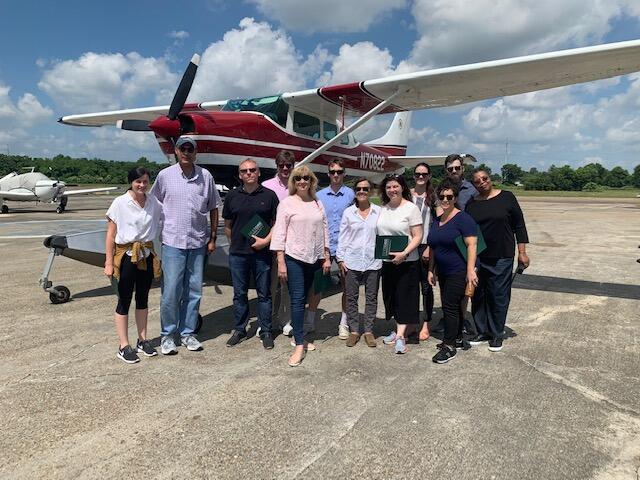
We woke up early the next day and convened at Lakeside Airport, where SouthWings, a non-profit organization whose mission is to “take people up in the air to see environmental challenges in a way no one bound to the Earth can” operates. We participated in a “fly-over” of Louisiana’s coast.
Here are some key highlights:
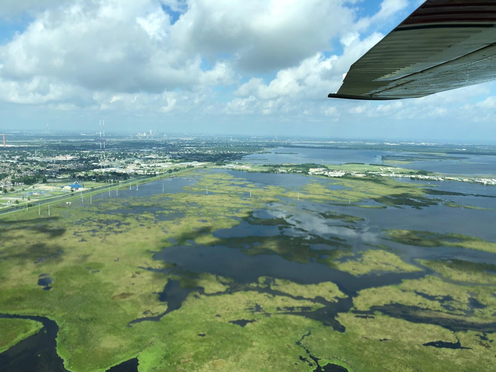
- We were able to see firsthand the stark statistics we use to inspire people to take action about the importance of restoring Louisiana’s coast: Louisiana loses a football field of land every 100 minutes; since the 1930s, we’ve lost land equivalent to the size of Delaware.
- We learned that barrier islands and wetlands help human-made features (such as levees) protect communities from extreme weather. Wetlands absorb water and wave energy during storms and flooding events, which help levees do their jobs to protect communities. Dredged sand rebuilds barrier islands to create and enhance habitat for birds like Black Skimmers and other shore-dwelling organisms like alligators and serve as a first line defense system against storms and protect wetlands from erosion.
- We saw how diversions work to restore wetlands and marshlands. After levees and flood control structures were installed along the Mississippi River to protect communities and allow for navigation, wetlands began to disappear. Wetlands need to be connected to rivers because rivers provide freshwater, sediment, and nutrients that help sustain and build wetlands. Diversions work to bring those essential materials back to the wetlands.
- Carnarvon Freshwater Diversion: We saw a freshwater diversion that discharges water and sediment from the Mississippi River into the Breton Sound to control salinity and build new wetlands. Thus far, it has built 1000 new acres of wetland. These wetlands are important for birds like Yellow Rails and Forester’s Terns
- Mid-Breton/Mid-Barataria Sediment Diversions: We saw planned sites for the Mid-Breton and Mid-Barataria Sediment Diversions, that once finalized, would build a total of 46,000 new acres of land over 50 years.
- Mardi Gras Pass: Near the levee, we saw healthy and abundant wetlands. In 2011, a breach in the levee caused a free flowing distributary of the Mississippi River, which was an example of how beneficial depositing sediment can be.
- During Hurricane Katrina, storm surge was funneled into the eastern side of New Orleans. As a response, the Army Corps of Engineers built a surge barrier to protect New Orleans against a 100-year storm. Behind the surge system, we saw an ongoing project – the Golden Triangle Marsh Creation project – which uses sediment nearby to restore 600 acres of marsh and protect communities from storm surge and flooding.
- We even got a quick history lesson by flying over Fort St. Phillip. The fort was built by the Spanish in the 1790’s to protect their territory in Louisiana from the French and British, but the fort saw most of its action during the war of 1812 and the American Civil War. Now, this historical site is also part of restoration. A terracing project has been built in this area, using dredged sediment to form elevated ridges of open water. These ridges act as “speed bumps” to slow the movement of water and enhance sediment deposition, which can convert open water into new wetlands.
- We flew over a community called Grand Bayou, one of the most remote Native American communities in the country and only accessible by boat. This community is mostly linked to the Atakapa-Ishak/Chawasha Tribe. We saw that their land is currently surrounded mostly by water, but in 1916, it was surrounded mostly by land. As sea levels continue to rise, more and more will lose their homes and land.
After the flyover, Charles Allen, Engagement Director for Audubon, took us to his community in the Lower Ninth Ward. The Lower Ninth Ward is a predominately-black community and endured a disproportionate amount of impacts caused by Hurricane Katrina, and not by chance. After the Civil War, black people and other racial minorities were “assigned” to live in low-value and flood-prone areas, such as the Lower Ninth Ward. As a result of Katrina, 53 percent of black residents lost everything while only 19 percent of white residents reported the same.
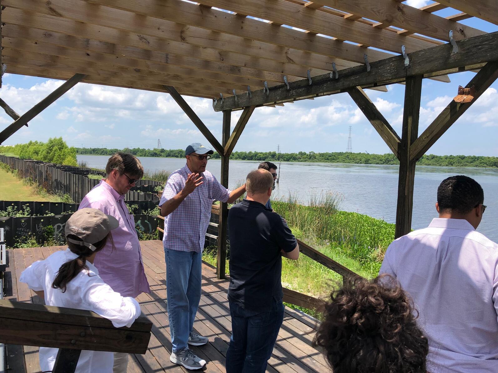
Our first stop in the Lower Ninth Ward was the Bienvenue Wetland Triangle, which was once an old-growth swamp filled with cypress trees, water lilies, and birds and other wildlife. Since the 1960s, when a shipping channel was created, saltwater has intruded into the wetland, causing the Cyprus trees to die and changed the wildlife species from freshwater to saltwater. This wetland was once a place to fish or harvest Cyprus wood for building, but now it is mostly open water. Additionally, Cyprus trees can serve as the first line of defense against storms. During Hurricane Katrina, the impacts of storm surge and flooding may have been lessened if that swamp were still intact.
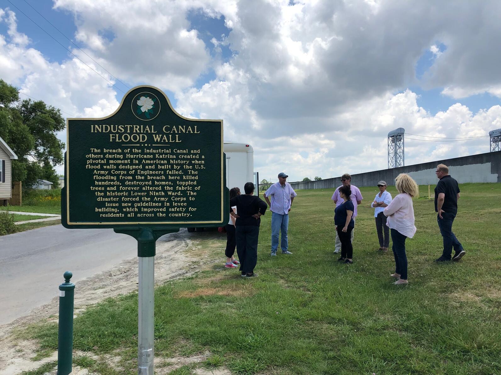
Our last stop was to the industrial canal flood wall, right where the levee breached during Hurricane Katrina in the Lower Ninth Ward. The area completely flooded as a result of the breach, causing the destruction of property, homes, and the neighborhood. The flooding that occurred because of Hurricane Katrina left the community changed forever. We noticed that many houses in the Lower Ninth Ward have not been rebuilt, as there are various empty lots.
This trip helped bring a diversity of perspectives to the work we do on the ground while showing us the imminent need for storm mitigation solutions to protect all communities from harm’s way. Let’s not repeat the aftermath of Hurricane Katrina: more restoration work is needed.